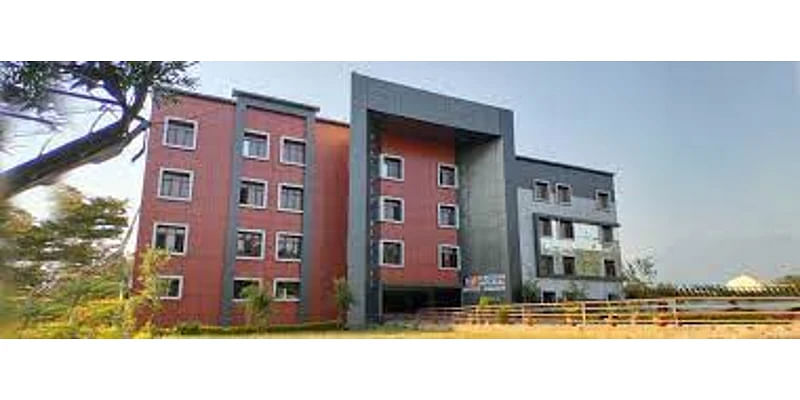
Indian Institute of Remote Sensing Admission 2025: Check Admission Details
- Dehradun , Uttarakhand
- (1 Reviews)
- 4.5 (1 Reviews)
Formerly referred to as Indian Photo-interpretation Institute (IPI), the Institute was founded on 21st April 1966 under the aegis of Survey of India (SOI). it had been established with the collaboration of the govt of Netherlands|Holland|European country|European nation">Netherlands on the pattern of college of Geo-Information Science and Earth Observation (ITC) of the University of Twente, formerly referred to as International Institute for Aerospace Survey and Earth Sciences, The Netherlands. the first idea of setting the Institute came from India's first Prime Minister Pandit Jawahar Lal Nehru during his visit to Netherlands in 1957.
The Institute's building at Kalidas Road, Dehradun was inaugurated on May 27, 1972. Since its founding, the Institute has been playing a key role in capacity building in remote sensing and geoinformatics technology and their applications for the advantage of the user community from India and abroad.
Keeping pace with the technological advances, the Institute has enhanced its capability with time, to satisfy the increased responsibility and demand from Indian and international community. Today, it's programmes for all levels of users, i.e. mid-career professionals, researchers, academia, fresh graduates and policy makers. The sustained efforts by its dedicated faculty and therefore the management have made the institute remain within the forefront throughout its journey of about four and a half decades from a photo-interpretation institute to an institute of a world stature within the field of remote sensing and geo-information science.
India decided to travel to space when Indian National Committee for Space Research (INCOSPAR) was found out by the govt of India in 1962. With the visionary Dr Vikram Sarabhai at its helm, INCOSPAR found out the Thumba Equatorial rocket firing Station (TERLS) in Thiruvananthapuram for upper atmospheric research.
Indian Space Research Organisation, formed in 1969, superseded the erstwhile INCOSPAR. Vikram Sarabhai, having identified the role and importance of space technology during a Nation's development, provided ISRO the required direction to function as an agent of development. ISRO then began its mission to supply the state space based services and to develop the technologies to realize an equivalent independently.
Throughout the years, ISRO has upheld its mission of bringing space to the service of the commoner, to the service of the state. Within the process, it's become one among the six largest space agencies within the world. ISRO maintains one among the most important fleet of communication satellites (INSAT) and remote sensing (IRS) satellites, that cater to the ever growing demand for fast and reliable communication and earth observation respectively. ISRO develops and delivers application specific satellite products and tools to the Nation: broadcasts, communications, weather forecasts, disaster management tools, Geographic Information Systems, cartography, navigation, telemedicine, dedicated distance education satellites being a number of them.
To achieve complete self-reliance in terms of those applications, it had been essential to develop cost efficient and reliable launch systems, which took shape within the sort of the Polar Satellite Launch Vehicle (PSLV). The famed PSLV went on to become a favoured carrier for satellites of varied countries thanks to its reliability and price efficiency, promoting unprecedented international collaboration. The Geosynchronous Satellite Launch Vehicle (GSLV) was developed keeping in mind the heavier and more demanding geosynchronous communication satellites.
Apart from technological capability, ISRO has also contributed to science and science education within the country. Various dedicated research centres and autonomous institutions for remote sensing, astronomy and astrophysics, atmospheric sciences and space sciences generally function under the aegis of Department of Space. ISRO's own Lunar and interplanetary missions along side other scientific projects encourage and promote science education, aside from providing valuable data to the scientific community which successively enriches science.
Future readiness is that the key to maintaining a foothold in technology and ISRO endeavours to optimise and enhance its technologies because the needs and ambitions of the country evolve. Thus, ISRO is moving forward with the event of heavy lift launchers, human spaceflight projects, reusable launch vehicles, semi-cryogenic engines, single and two stage to orbit (SSTO and TSTO) vehicles, development and use of composite materials for space applications etc. Know more about ISRO's genesis.
Indian Institute of Remote Sensing Quick Links
- Indian Institute of Remote Sensing Admission
- Indian Institute of Remote Sensing PG Admission
- Indian Institute of Remote Sensing Application Form
- Indian Institute of Remote Sensing Admission Helpline
Indian Institute of Remote Sensing Admission 2025
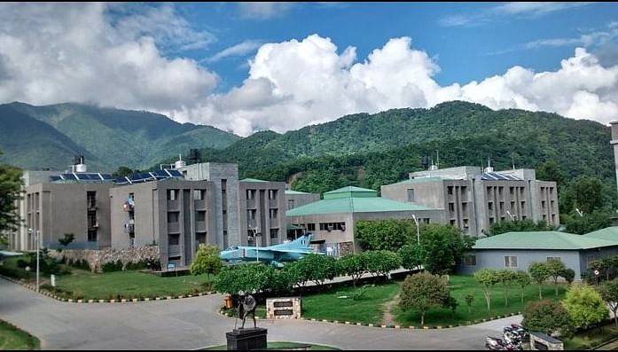
- Indian Institute of Remote Sensing (IIRS) may be a premier institute with a primary aim to create capacity in Remote Sensing and Geoinformatics technologies, which came into existence in 1966. The institute is approved by MHRD and is working from its campus located at 4, Kalidas Rd, Hathibarkala, Dehradun, within the state of Uttarakhand.
- The institute offers Education, Training, IIRS, and International Training programmes.
- IIRS offers M.Tech, M.Sc and PG Diploma programs under education programme that admissions are on the idea of entrance examination.
- Government-sponsored candidates and foriegn candidates are exempted from the doorway exam. However, the foreign candidates need to give interviews through online mode.
- IIRS may be a Unit of the Indian Space Research Organisation (ISRO), Department of Space, and Government of India.
Indian Institute of Remote Sensing PG Admission 2025
M.Sc Admission
Indian Institute of Remote Sensing offers M.Sc in Geo-information Science and Earth Observation (specialisation: Geoinformatics) is obtainable within the framework of Joint Education Programme (JEP) of the Indian Institute of Remote Sensing.
The course is of two years duration having eight quartiles. Students follow a part of the course at IIRS and a neighborhood at the ITC (~5 months). Admissions are on the idea of the doorway exam conducted by IIRS.
The total intake of the programme is 10 seats.
Eligibility Criteria
Candidates who have a graduate degree in B.E/B.Tech or M.Tech/M.Sc degree within the relevant discipline are eligible for the programme.
Admissions to the present programme at IIRS is predicated on the doorway conducted by IIRS, while the govt sponsored candidates are exempted from the test. Foriegn candidates are selected on the idea of interview.
M.Tech Admission
Indian Institute of Remote Sensing offers M.Tech in Remote Sensing & GIS under 9 specialisations.
The aim of the M.Tech course is to supply in-depth understanding of remote sensing, satellite image analysis, Geographic data system and Global Navigation Satellite System (GNSS) technologies and their applications in natural resources.
Eligibility: Candidates who have a graduate degree in B.E/B.Tech or M.Sc degree within the relevant discipline are eligible for the programme.
Selection for admission to M.Tech.course is predicated on the doorway Test. Govt.-sponsored candidates are exempted from the doorway test. Foreign candidates also are exempted from entrance test but they need to seem for interview through online platforms.
The Post Graduate Diploma programme is obtainable in Remote Sensing & GIS in 9 specializations for a period of 1 years, consisting of three modules. the primary module is common to all or any the participants, which deals with Geospatial Technologies that specialize in Fundamentals of Remote Sensing & Photogrammetry and Basics of GIS. within the second module, the participants are going to be exposed to application of geospatial technologies in their respective specialisations. Participants will perform a pilot program within the third module.
Eligibility Criteria
Selection for admission to PG Diploma course is predicated on the doorway Test. Govt.-sponsored candidates are exempted from the doorway test. Foreign candidates also are exempted from the entrance test but they need to seem for interview through online platforms.
How To Apply For Indian Institute Of Remote Sensing?
Candidates seeking admission can register themselves for IIRs entrance examination by visiting the official website. Whereas, the candidates seeking admission in PG Diploma courses and Sponsored courses, must download the appliance form from the official website.
How to apply?
- Visit the official website of IIRS.
- Go to the tutorial Programs tab followed by the appliance Form page.
- Login/Register
- Enter your personal details.
- Enter your address details.
- Enter your education details.
- Enter other details.
- Upload Photo, ID & Signature.
- Select Course
- Submit the appliance form.
Indian Institute of Remote Sensing Application Form
- Only Online Applications are going to be considered, apart from the O-DM course (Sl. No. 21)and C-SC course (Sl. No. 35)
- Application Fee for Courses at Sl. No. 1 to 20, 24: For Indian nationals –Rs. 1,000*; For Foreign nationals –USD100*.
- The fee should be paid online.
- Candidate applying for both P.G. Diploma (Sl. No. 1-9) and M.Tech. (Sl. No. 10-18) will need to pay the appliance Fee Rs. of 1500/-(USD 150 for foreign nationals). Candidate has got to choose just one specialization at the time of applying online, which can't be changed subsequently. Further, if the candidate wishes to use for P.G. Diploma also as M.Tech., he/she has got to select an equivalent specialization for both the courses, give the order of preference for P.G. Diploma, and M.Tech, and pay the requisite application fee.
- *Candidate applying for both P.G. Diploma in Geoinformatics (D-GI; Sl. No. 19) and M.Sc. in Geoinformatics (MS-GI; Sl. No. 20) will need to pay the appliance Fee Rs. of 1500/-(USD 150 for foreign nationals). Further, if the candidate wishes to use for P.G. Diploma in Geoinformatics (D-GI) also as M.Sc. in Geoinformatics (MS-GI), he/she has got to select both the courses, give the order of preference, and pay the requisite application fee.
- Instructions for Appearing Candidates:
- Candidates within the final semester/year of the qualifying degree also can apply for the P.G. Diploma, M.Tech. and M.Sc. courses(mentioned above at Sl. No. 1 to 20) under the “Result Awaited” category. However, such candidates must submit the proof of marks/grades (cumulative marks/CGPA) till the pre-final semester/year at the time of submitting the web application, without which the appliance is going to be treated as incomplete and can be rejected.
- Admission of such appearing candidates, if selected, are going to be provisional and that they will need to submit the mark sheets/certificates of ultimate semester/year on the date of registration (during admission) or before the last date as announced/decidedby IIRS. Non-fulfillment of this condition will automatically end in the cancellation of the provisional admission.
- Instructions for Govt.-sponsored Candidates:
- -Govt.-sponsored candidate means only the Permanent Employee nominated bya Govt. organization in India(Central or government Ministries/Departments or Autonomous Institutions and State orCentral Govt.-funded Universities). Nominating organizations are required to satisfy all expenses viz., traveling allowance, daily allowance, contingent expenses, medical expenses, etc.for their candidates.
- Courses at Sl. Nos. 21,24, 36-39are paid courses for all,including candidates nominated by the govt. . organizations.
- -sponsored candidates must submit the Nomination Form from the Competent Authority of their parent organisation/institute at the time of submitting the web application. The template of the Nomination Form are often downloaded from https://admissions.iirs.gov.in.
- Incase of NNRMS-ISROsponsored courses(S. No. 25to 34), Regular/Permanent faculty members (teachers) of UGC/AICTE approved universities & their affiliated colleges nominated by Vice Chancellor/ Principal/ Registrar/ Dean, and Regular/Permanent Faculty/Scientists/Engineers/Officers nominated by the competent authority of the Central/State Govt. organisations/institutions are going to be considered as NNRMS/ISRO-sponsored candidates. Such candidates are going to be eligible for payment of TA (2nd AC train fare) and nominal living expenses by IIRS as per the supply available under this programmeand as per rules.Further, such candidates must submit Nomination Form from the Competent Authority of their parent organisation/institute at the time of submitting the web application.The template of the Nomination Form are often downloaded from https://admissions.iirs.gov.in.All such candidates who haven't submitted the Nomination Form from the Competent Authority of their parent organisation/institute or those that aren't entitled for being considered as NNRMS/ISRO-sponsored candidates, are going to be treated as Self-Financed candidates.
- Candidate should ensure his/her eligibility then apply for the relevant course(s). Incomplete application (including non-payment of application fee, whereverapplicable) are going to be summarily rejected.
- Course fee and other expenditure are likely to vary as per IIRS and collaborating University’s/ Institute’s policy.
- Payment of Fee:
- Self-financed candidates, if selectedin courses mentioned at S.No. 1-20of thiscalendar, need to make an payment of Rs.10,000/-(subject to change) on or before the last date mentionedin the letter sent bythe Institute (IIRS)for confirmation of seat,failing which seats willbe offered to the wait-listed candidates; thisamountwill be adjusted within the course feelater.Remaining fee will need to be paid on or before the date specified by IIRS. Refund of fee are going to be governed by the fee refund policy of IIRS(available in website).
- For courses at Sl.No. 21, 24, 36-39(Govt.-sponsored & self-financed candidates) andSl. No. 25-34 (for self-financed candidates), full fee has got to be paid on or before the date specified by IIRS before the commencement of the course. Refund of fee are going to be governed by the fee refund policy of IIRS(available in website).
- Boarding and lodging chargesinIIRS Hostel are currently Rs. 4,500/-to Rs. 6,000-per month(approx.). Local candidates are going to be considered for hostel accommodation,only if available.
- Increase and reduce in number of seatsand age/qualificationrelaxation for candidates nominated by the govt. . organizations are going to be at the discretion of the institute.In the event of number of applications being large, institute may adopt short-listing criteria supported academic record, relevant experience, etc. Government-sponsored candidateswill tend preferencefor admission.
- If the date in fact commencement falls on a vacation, course will start from next working day.
- The medium of instructions within the courses is English.
Indian Institute of Remote Sensing Admission Helpline
|
Indian Institute of Remote Sensing |
|
|
Address |
4, Kalidas Rd, Hathibarkala, Dehradun, Uttarakhand 248001 |
|
|
elearning@iirs.gov.in. dlp@iirs.gov.in |
|
Phone no. |
0135 252 4338 |
Indian Institute of Remote Sensing Reviews
4.5
>4-5 star
1
>3-4 star
0
>2-3 star
0
1-2 star
0
Academics & Faculty
4.5
Fees & Scholarships
5
Placements & Internships
3.5
College Infrastructure & Hostel Facilities
4.5
Clubs & Associations
5
Academics & Faculty : Daily routine is quite manageble. If I talk about projects and assignments, they are very helpful and informative and are making us aware of the challenges faced by the society. The teachers are very good, h
Read More
Contact Details
Contact Us
- Indian Institute of Remote Sensing - #4, Kalidas Road, Dehradun, Uttarakhand 248001
- 91 -135 - 2524399
- websupport[at]iirs[dot]gov[dot]in
- www.iirs.gov.in

