M.Sc Geoinformatics

Master of Science in Geoinformatics is a two-year postgraduate program that deals with the study of geographic information systems. M.Sc Geoinformatics offers candidates to set up a career in various areas of radiology and technician. Some of the jobs for postgraduates include GIS Officer, GIS Administrator, Geographer, GIS Manager, GIS Technician, etc.
M.Sc Geoinformatics Course Details
| Degree | Masters |
| Full Form | Master of Science (Geoinformatics) |
| Duration | 2 Years |
| Age | No age Limit |
| Average Fees | ₹15K - 4 LPA |
| Average Salary | INR 2- 8 LPA [Source: Glassdoor] |
| Employment Roles | GIS Technicians, GIS Analyst, GIS Administrator, GIS Professional, GIS manager, etc |
About M.Sc Geoinformatics
Master of Science in Geoinformatics is a postgraduate course curated into two years and is divided into four semesters. Through this course, students are given a basic understanding of the technology and science behind the working of geographic information systems. The course falls under the umbrella of the M.Sc course and therefore, follows a similar admission process.
According to Wikipedia, “The M.Sc Geoinformatics is the postgraduate program in the information science sector awarded by universities and conservatories. The course combines advanced studies in an applied area of science and technology which develops and uses information science infrastructure to address the problems of Geography, Cartography, Geosciences, and related branches of Science and Engineering.
Table of Contents
- M.Sc Geoinformatics eligibility Criteria
- M.Sc Geoinformatics Admission Process
- M.Sc Geoinformatics Entrance Exams
- Top M.Sc Geoinformatics Colleges
- Fees Structure for M.Sc Geoinformatics
- Syllabus and Subjects for M.Sc Geoinformatics
- Why Choose M.Sc Geoinformatics?
- Preparation Tips for M.Sc Geoinformatics
- Scope of Higher Education after M.Sc Geoinformatics
- M.Sc Geoinformatics Salary
- Career Options After M.Sc Geoinformatics
- Skills to Excel
Eligibility Criteria for M.Sc Geoinformatics
M.Sc Geoinformatics admission is offered to only those students who meet the eligibility requirements. The candidates must have a B.Sc or any other degree in science, physics, mathematics, engineering with a minimum 50% aggregate score in the final examination. There is no age limit for the course. The admission process can be either entrance exam-based or merit-based.
How To Get Admission in M.Sc Geoinformatics?
Students must ensure that they satisfy the eligibility criteria for M.Sc Geoinformatics in India. M.Sc Geoinformatics admission 2021 is done through entrance exam scores or on a merit basis. Admission procedures may vary across different M.Sc Geoinformatics universities in India. Mentioned below are the details of the admission process in general:
How to Apply?
M.Sc Geoinformatics course details and procedures for admission can be found on the college's official websites. To apply for the course, visit the official university admission portal and register for the entrance exam. After that fill the application form by providing the required details.
Selection Process
Admission is strictly offered to only those students who clear the M.Sc Geoinformatics eligibility criteria. The list of shortlisted candidates can be availed through the college’s official website or will be informed via email regarding the result and the further admission process.
Popular Entrance Exams for M.Sc Geoinformatics
Admission to the M.Sc Geoinformatics course in India is mainly through entrance examinations. Entrance exams for M.Sc Geoinformatics India are usually conducted on the university level. The most common exams that most candidates apply to are as follows:
A Quick Glance at the M.Sc Geoinformatics Entrance Exams
To get admitted, students must ensure whether they satisfy the eligibility for the M.Sc Geoinformatics course. To clear the entrance exam, students should study the exam pattern and syllabus well before time. This will assist students in timely preparation for the entrance exams. Listed below is the general pattern for the entrance exams:
- The entrance exam has multiple sections that test different parts of your knowledge from BSc subjects and physics, chemistry, mathematics, engineering subjects, etc.
- The examination will be conducted through offline mode or online mode.
- The time duration to complete the paper is 3 hours.
- Paper consists of 90 multiple choice questions carrying 300 marks.
Top 10 M.Sc Geoinformatics Colleges in India
Various institutes offer M.Sc Geoinformatics. Students can opt for the M.Sc Geoinformatics best college depending upon their merit and specialization needed. Some of the M.Sc Geoinformatics top colleges are listed below:
|
SL.No |
Name of the institute |
|
1 |
|
|
2 |
|
|
3 |
|
|
4 |
|
|
5 |
|
|
6 |
|
|
7 |
|
|
8 |
|
|
9 |
|
|
10 |
Fee Structure for M.Sc Geoinformatics
M.Sc Geoinformatics fees range from INR 10,000 - 5 LPA. The fees may vary according to the college or university based on the type of institute, location, infrastructure, faculties, and facilities available. Below listed are the M.Sc Geoinformatics fees structure of some colleges:
|
Sl. No. |
Name of the Institute |
Average Annual Fees |
|
1 |
Teri University, New Delhi |
INR 5 LPA |
|
2 |
Symbiosis Institute Of Geoinformatics, Pune |
INR 4 LPA |
|
3 |
IIRS, Dehradun |
INR 50,000 PA |
|
4 |
Birla Institute Of Technology, Ranchi |
INR 3 LPA |
|
5 |
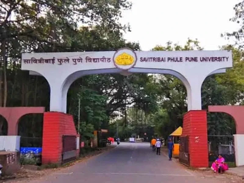
Savitribai Phule Pune University, Pune |
INR 40 PA |
Syllabus and Subjects for M.Sc Geoinformatics
Master of Science in Geoinformatics is a two-year postgraduate course in Geoinformatics. M.Sc Geoinformatics course is a comprehensive study on developing science graduates in the field of informatics of the earth. The subjects related to this course vary according to specializations and the institutes. The syllabus includes theory papers and a project paper. The compulsory subjects include:
- Principles of GIS and GPS
- Environmental Statistics
- Environmental Management System
- Spatial Data Modelling and GIS applications
- Principles of Cartography
Read More About M.Sc Geoinformatics Syllabus and Subjects
Why Choose M.Sc Geoinformatics?
Students often wonder about M.Sc Geoinformatics course details before choosing the course. Before deciding on a career, students come across queries like, "What is the M.Sc Geoinformatics course?" and "Why choose M.Sc Geoinformatics?”. To clearly understand answers to these questions, we have framed the following three pointers:
What is M.Sc Geoinformatics All About?
Master of Science in Geoinformatics is a postgraduate program that deals with the study of information environment science with problems related to geographical situations. This M.Sc course provides a roundup view of the course majorly focused on the management of resources and facilities. Candidates who want to gain the depth of knowledge in these fields required for solving real-world problems are suitable for it. After completing the course, the postgraduates are usually hired as GIS Technicians, GIS Analyst, GIS Administrator, GIS Professional, GIS managers, etc.
What Does an M.Sc Geoinformatics Graduate Do?
The M.Sc Geoinformatics postgraduates can find jobs in areas like Indian Space Research Organisations, Space Application Centre and so on. They can work as Assistant Professor, GIS Specialist, GPS Technician, GIS Officer, Environmental Officer, etc.
GIS Technician: deals with the role of analysis, programming, and mapping in their work. Their main responsibilities include using mapping software to analyze spatial data and creating digital maps using geographic data and other data sets.
Reasons Why M.Sc Geoinformatics Can Fetch You a Rewarding Career?
Career prospects for M.Sc Geoinformatics greatly vary. It depends on the respective specialization and demand. Candidates also make use of the environmental education with science to provide the degree to get a job in the Environment sector, Government, University Administration, or in Research and Development.
Career Scope and Options: The postgraduates can work in Environmental Agencies, Private Agencies, Forestry, NGOs, Schools, Colleges and Universities, etc. An M.Sc Geoinformatics provides a lot of job opportunities, aspirants who have completed the course can mainly start a career as GIS Technicians, GIS Analyst, GIS Administrator, GIS Professional, GIS Manager, etc.
Read More About M.Sc Geoinformatics Job Scope & Opportunities
Preparation Tips for M.Sc Geoinformatics
Some of the course preparation tips for the M.Sc Geoinformatics course are listed below:
Know The Syllabus And Exam Pattern: To prepare well for the entrance exams the candidates should be aware of the syllabus, exam pattern, and the books to equip the knowledge required.
Practice Question Papers: Practice solving previous years’ papers to understand the type of questions asked. It also helps to improve and prepare yourself for the actual exam.
Take Mock Tests: Solving as many mock tests can help students gain speed and accuracy.
Prepare Time Table: Finish preparation well in advance, to have enough time for revision of the content.
Scope For Higher Education
After completion of M.Sc Geoinformatics, the candidates can choose to take up jobs or can continue with their higher studies. An additional degree in the same field improves job opportunities. The graduates can specialize in specific areas like Indian Space Research Organisations, Space Application Centre North East Space Application Centre, National Remote Sensing Agency, and much more. Some higher education options are:
Salary of an M.Sc Geoinformatics Graduate
The average salary of an employee with a degree in Master of Science Geoinformatics is INR 3- 7 LPA (Source: Glassdoor) for freshers. The salaries and annual earnings depend on the specific companies they work for, the methods of practice, expertise, and other related aspects.
Read More About M.Sc Geoinformatics Salary
Career Options After M.Sc Geoinformatics
After completion of the course, the postgraduates can find jobs in areas like Research & Development, Space Research Centres, Environmental Organizations, Private Firms, colleges & Universities, etc. The postgraduates can even apply for the UGC-NET or SET exam. Clearing these exams makes a career in teaching or research. Some job roles offered to postgraduates are:
- GIS Technician
- GIS Officer
- GIS Manager
- GIS Developer
- GIS Administrator
Skills That Make You The Best M.Sc Geoinformatics Graduate
Some people are passionate about working in the environmental sector and solving problems related to the geography of a place professionally in the future. M.Sc Geoinformatics is wide-ranging and deep in the subjects it explores the different methods and technological advancements in the environmental sector. Some required skills are:
- Ability to work long hours, often under pressure
- Effective decision-making skills
- Leadership and management skills
- Analytical ability
- Time management
Top M.Sc Geoinformatics Colleges
Top Science Entrance Exams
M.Sc Geoinformatics Fee Structure
FAQs on M.Sc Geoinformatics
Q: What is the scope for the M.Sc Geoinformatics?
Q: What is the duration of this course?
Q: What is the salary for this Course?
Q: What are the Fees for M.Sc Geoinformatics?
Q: Can I do M.Sc Geoinformatics after B.Tech (ECE)?
